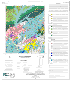

The geologic map for the Cokesbury quadrangle has been created as a general-purpose map that is applicable to land-related investigations in the earth, environmental and biological sciences. Includes rock unit descriptions. By J. Robert Butler, Timothy W. Clark and Norman K. Gay, 2016. Approximate scale - 1:24,000. Approximate size is 42"x34".
|


