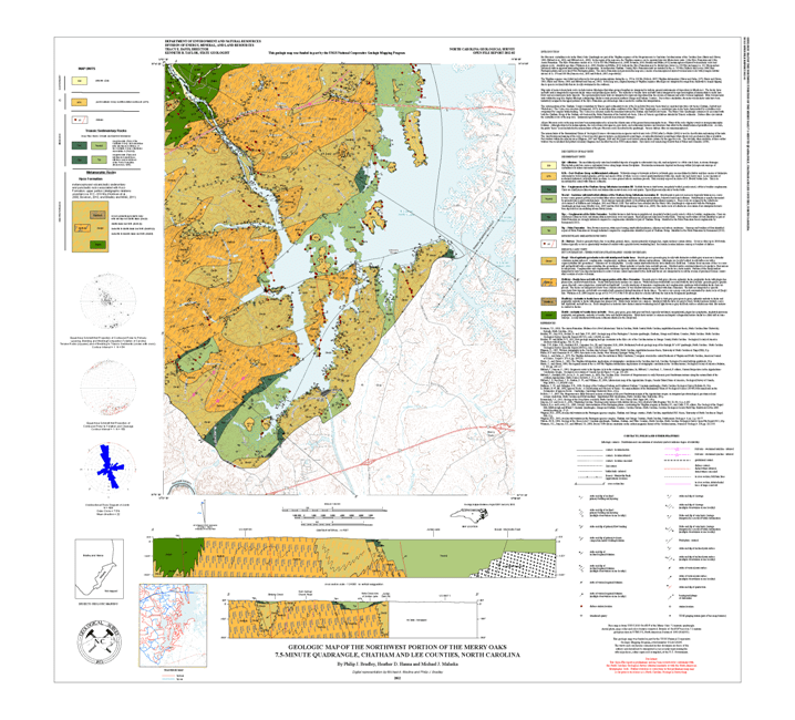

The geologic map for the Merry Oaks quadrangle has been created as a general-purpose map that is applicable to land-related investigations in the earth, environmental and biological sciences. Includes stereonets and a rose diagram, two cross sections, and rock unit descriptions.
By Philip J. Bradley, Heather D. Hanna and Michael J. Malaska. Approximate scale - 1:24,000. Approximate size is 38"x42". 2012.
|