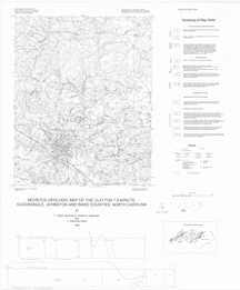
The geologic map for the Clayton quadrangle has been created as a general-purpose map that is applicable to land-related investigations in the earth, environmental and biological sciences. Includes two cross sections and rock unit descriptions. By P. Albert Carpenter, III, Robert H. Carpenter and J. Alexander Speer. 1998. Black and white map. Approximate size - 36"x42". Approximate scale - 1:24,000.
|